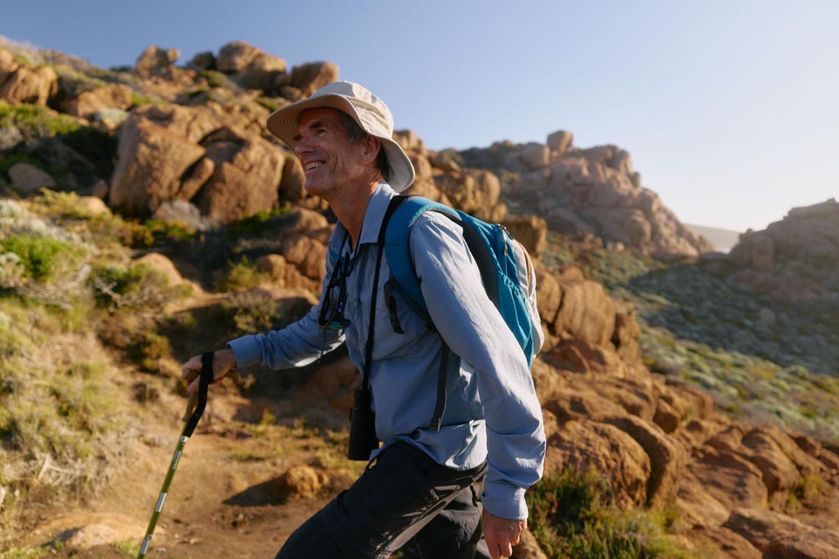
About the track
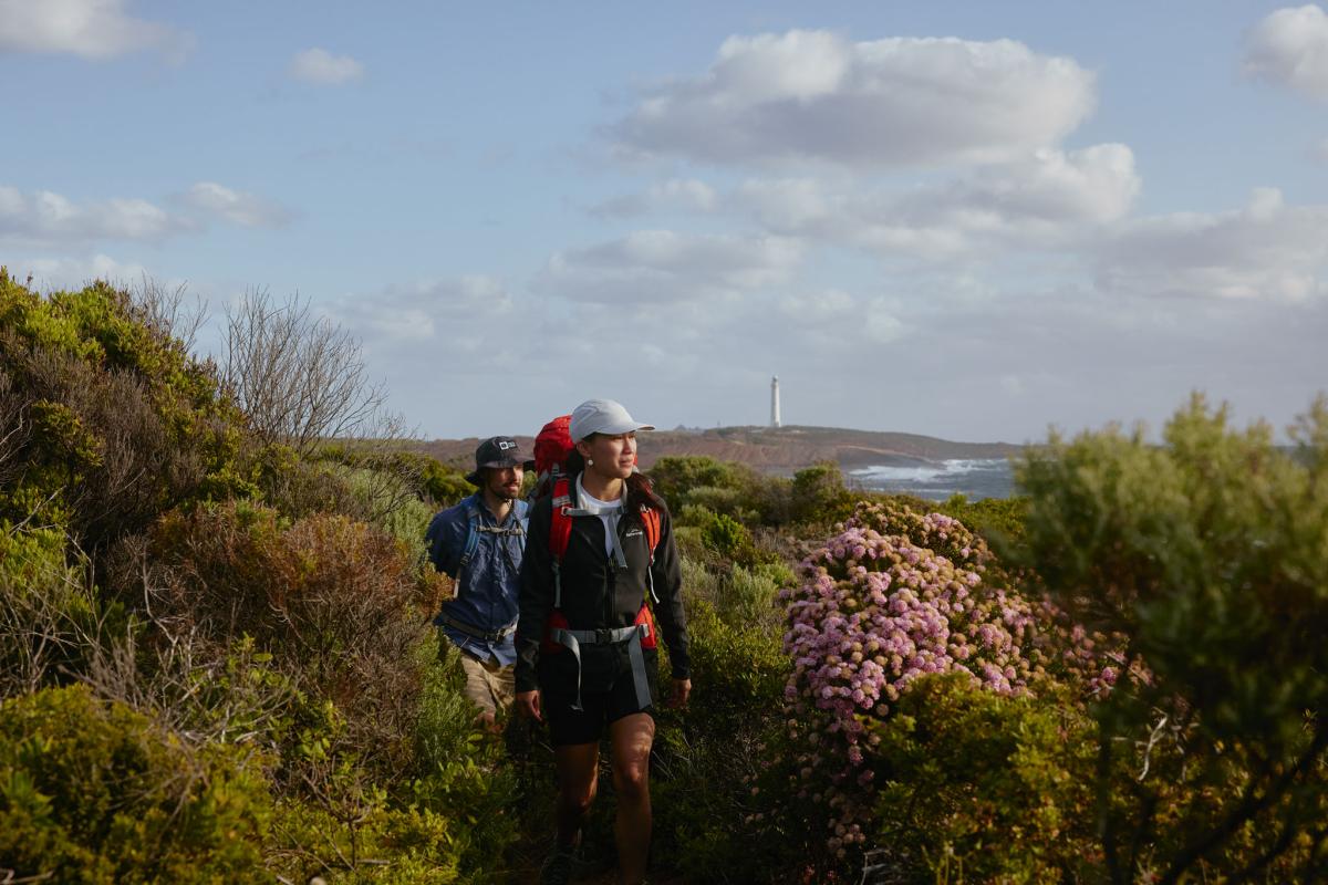
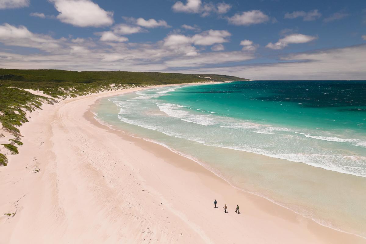
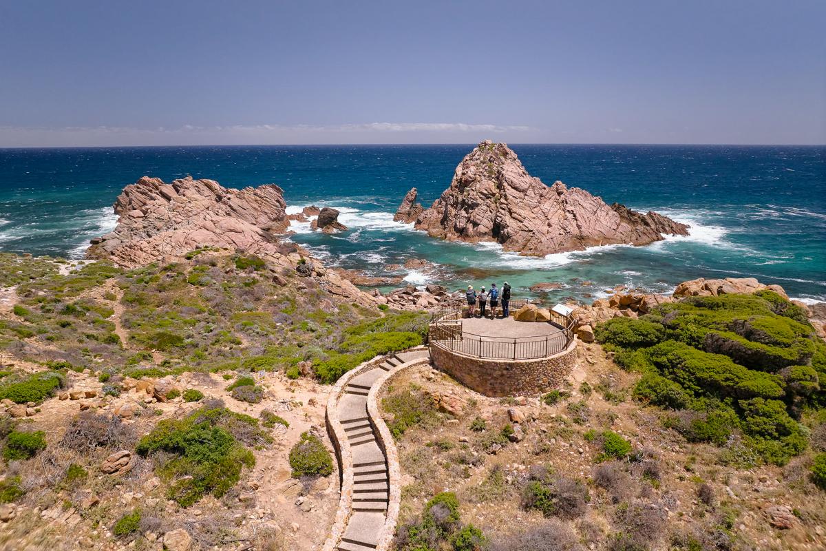
The 130km Cape to Cape Track traverses the length of Leeuwin-Naturaliste National Park and overlooks the adjoining Ngari Capes Marine Park, alternating spectacular sweeping clifftop views with stretches of pristine beach.
At any time of the year there's a good chance of seeing dolphins, and between May and December whales pass close to shore on their annual migration. Most are humpbacks, the species that breaches the surface more than any other, but you may also see southern right whales, and if you're very lucky, a blue whale.
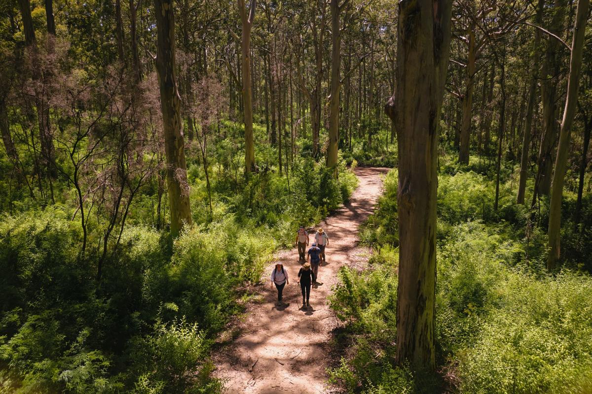
It's not all about the coast though, there are several inland excursions which take in some lovely sheltered woodland sections, as well as the magnificent Boranup Forest of towering karri. The track varies from sealed, mostly flat pathways to steep, rough tracks and sandy beaches.
To tackle the whole track in one trip is a great challenge (usually 5 – 7 days), but multiple vehicle access points allow it to be completed in smaller segments. Camping options include basic track campsites and national park campgrounds with vehicle access. You can also organise transfers to accommodation at towns along the way.
Leeuwin-Naturaliste is one of our most popular parks and part one of the country's most well-known tourist destinations. Anyone planning to walk the Cape to Cape Track during peak periods (see Know: When to visit) should book accommodation early, and consider allowing extra travelling time from Perth.
Click here for the latest Track conditions.
Track highlights and shorter hikes
(Distances are one way)
- Cape Naturaliste to Sugarloaf Rock (3.4km of sealed pathways suitable for assisted wheelchairs and prams).
- Smiths Point to Injidup Beach (5.8km)
- Moses Rock to Quininup Falls (1.9km)
- Redgate Beach to Conto Road (6.6km)
River crossings
For most of the year the Margaret River, about mid-way along the track, can be crossed with care at its mouth, but there are periods in winter when it is not safe to cross and walkers will have to take an inland diversion to cross at the bridge upstream. The river mouth can be accessed by vehicle at the southern side, but not from the north - walkers from the north have no alternative but to retrace their steps if the river mouth cannot be crossed.
Maps, guides and downloads
Maps and guidebooks can be purchased from our not-for-profit community partner the Friends of the Cape to Cape Track or the WA Naturally shop. The Friends' coordinate a track adoption program and offer a series of guided walks. Other organised walking tours can be found here.
FAQs
Download the Cape to Cape Track FAQs.
Safety information
Plan when to visit. Read this safety information about bushwalking. Consider traveling with a personal location beacon (PLB). In the event you need to be rescued it could save your life!
- Plan your visits for cooler periods of the year, avoiding the hot summer months.
- Check the Fire Danger Rating and do not go on or remain on the trails if the forecast is Extreme or Catastrophic.
- Do not plan extended multi-day trips beyond the Fire Danger Rating forecast during summer as, due to limited mobile phone coverage, it is not always possible to keep updated with changing conditions.
- Avoid remote sections of the trail where there is limited vehicle access.
- Abide by all trail closure signage, and any instructions from Parks and Wildlife and other emergency staff.
Trails and parks may be closed on days when the Fire Danger Rating is Extreme or Catastrophic. Check these websites when planning your walks:
- Emergency WA – information about Fire Danger Ratings, current warnings and incidents
- Bureau of Meteorology – for weather forecasts and Fire Danger Ratings
Install the free Emergency+ app on your mobile phone and use it in any emergency to call for assistance. If there is no mobile phone coverage you will not be able to call 000 but the app will provide you with GPS location details. Keep your phone fully charged and with location services turned on.n.
Download 'Are you bushfire ready?'
It is recommended that you inform friends, family and/or police of your travel dates and the locations you plan to visit (your itinerary) during your travels into parks and reserves in Western Australia. Provide them with regular updates to ensure they know where you are. Agree on what they should do if you are overdue or do not return when you said you would. Use this form and provide sufficient detail so that they have the information needed to get help if required.
Gallery


Bushfire safety
Watch the video below to learn why it's important to plan ahead, check weather conditions and have a bushfire plan.
Groups on the track
Cape to Cape campsites cannot be reserved but early notification of a groups’ intentions to use campsites enables us to inform other walkers when these facilities will be occupied by those groups.
Download and complete this form, then email it to conto.campground@dbca.wa.gov.au.
If you're planning a school excursion or outdoor education activity, find out all you need to know about group bookings and approvals at Outdoor in education parks and reserves.
Proposed prescribed burns
The Parks and Wildlife Service conducts a year-round program of prescribed burning. These burns are undertaken primarily for property protection, fuel reduction and biodiversity management. To view all proposed prescribed burns check the department's indicative burn plan.
These burns are carefully planned however they may cause some disruptions to walkers and riders. Where prescribed burns impact on the trail, closures and diversions are implemented to ensure the safety of walkers and riders, including temporary camp sites where necessary. These will remain in place until the original trail alignment has been declared safe. For diversions and smoke warnings check Park Alerts
For your safety follow all signs, diversions and instructions from Parks and Wildlife staff and other emergency personnel.
Prescribed burns are dependent on appropriate weather conditions and, as such, burning dates are not available in advance.
Downloadable route files
This downloadable route data is for visual representation during trip planning and is not intended as a navigation tool. Remember to carry hard-copy maps and a compass with you at all times (and know how to use them). Do not rely on any electronic equipment – batteries might expire, the device might fail or break, and can be unreliable under trees.
This alignment data does not include diversions. Follow all on-ground diversion signage – these are in place for your safety. Downloadable GPX and KML files of the trail alignments can be accessed from the Western Australian Government Open Data website.
The route data will be updated as changes are made to the alignment. Check back regularly to ensure that you have the most current version. If you find errors please let us know by calling (08) 9219 8265 or emailing recreationandtrails@dbca.wa.gov.au.
Disclaimer: By downloading this GPX or KML file you agree its use, and reliance upon, is entirely at your own risk. These files are for non-commercial, personal use only. The Department of Biodiversity, Conservation and Attractions' Parks and Wildlife Service endeavoured to ensure the accuracy and currency of the data, but accepts no responsibility in this regard, or the results of any actions taken, when using the digital route files.
Trail conditions and diversions
Occasionally temporary trail closures are necessary due to maintenance, prescribed burns, bushfires or severe weather. If part of the trail is closed, a diversion may be marked and signage placed at either end. Check the current conditions in the area you are walking or cycling.
Information below is updated during business hours. More up-to-date information is available from the Parks and Wildlife office closest to the area you are planning to visit.
Leave No Trace
Watch the video below to learn about the seven Leave No Trace principles that you can apply while out on the track.
Facilities
Water tap
Untreated tank water
Toilet
Picnic table
Lookout/Deck
Activities
Bushwalking
Overnight hiking
Traditional Owners
We recognise and acknowledge Aboriginal people as the Traditional Owners of Cape to Cape Track.