Park Feature - Porongurup National Park
This article appeared in LANDSCOPE magazine Spring 2024.
Porongurup National Park, is about 40 minutes drive from Albany on Western Australia's south coast, and is home to the spectacular Porongurup Range. The granite peaks of the range rise and fall for 12 kilometres, reaching to 670 metres high and provide views of the Stirling Range and - on a clear day - the Southern Ocean.
Porongurup is an ancient mountain in an ancient mountain land, known to the original inhabitants of the area as Borongur. There are four Noongar Aboriginal peoples in the area including the Menang people of the Albany region, the Wirlomin people (Gnowangerup), Bibbulmun people (Denmark) and Goreng people (Plantangenant/Gnowangurup and Katanning) and who all consider the Porongurup Range particularly important - both culturally and spiritually.
"Porongurup is our most culturally sacred site in this particular region, and it is of significance to the whole Noongar nation," said Vernice Gillies, a Menang Elder.
Natural beauty
The park is home to lush karri forest, towering granite peaks and spectacular displays of wildflowers in the springtime.
The granite rock that forms the Porongurup Range is more than 1100 million years old. This ancient landscape was exposed by the relentless forces of nature as it weathered away softer rocks surrounding the ridge to reveal the range's outlines. In the process, the range became an ecological island. Its climate and soils differ greatly from the surrounding lowlands and protect a suite of plants and animals not present in the nearby surrounds.
Perhaps the most well known of these species is the mighty karri (Eucalyptus diversicolor) that cloaks the range in green growth. Fossil pollen found throughout the south-west shows that, after an earlier wetter era, karri forest retreated to its present stronghold between Manjimup and Walpole. However, where the soil was right and the rainfall higher, small outlying populations survived. The Porongurup Range is one such island of karri growth.
Many of the plants and animals of the main belt of karri forest have also survived here. Visitors may see western grey kangaroos (Macropus fuliginosus), brush wallabies (Notamacropus irma), birds such as the rufous tree-creeper (Climacteris rufus) and the brilliant scarlet and western yellow robins (Petroica boodang and Eopsaltria griseogularis).
About 750 plant species occur in the park and the local flora is particularly beautiful in the springtime when wildflowers burst into bloom. Wattle and hovea plants are stunning when they occur en masse, and around
55 species of orchid also occur in the park.
Exploring the park
A 23-kilometre scenic drive winds around the entirety of the park on mostly sealed roads offering views over the range. There’s also a shorter five-kilometre stretch of Angwin Road for views over the granite outcrops and Stirling Range to the north.
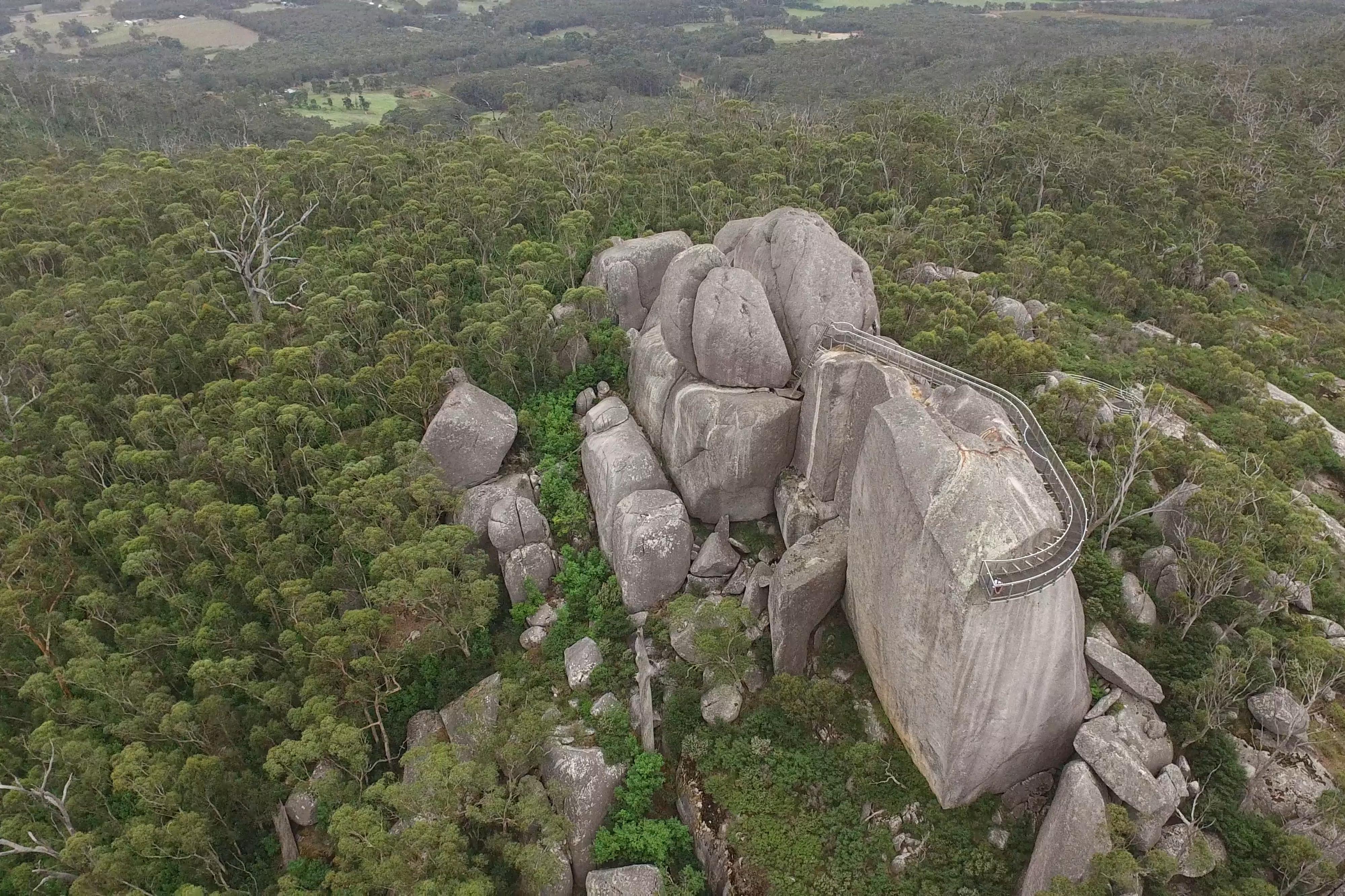
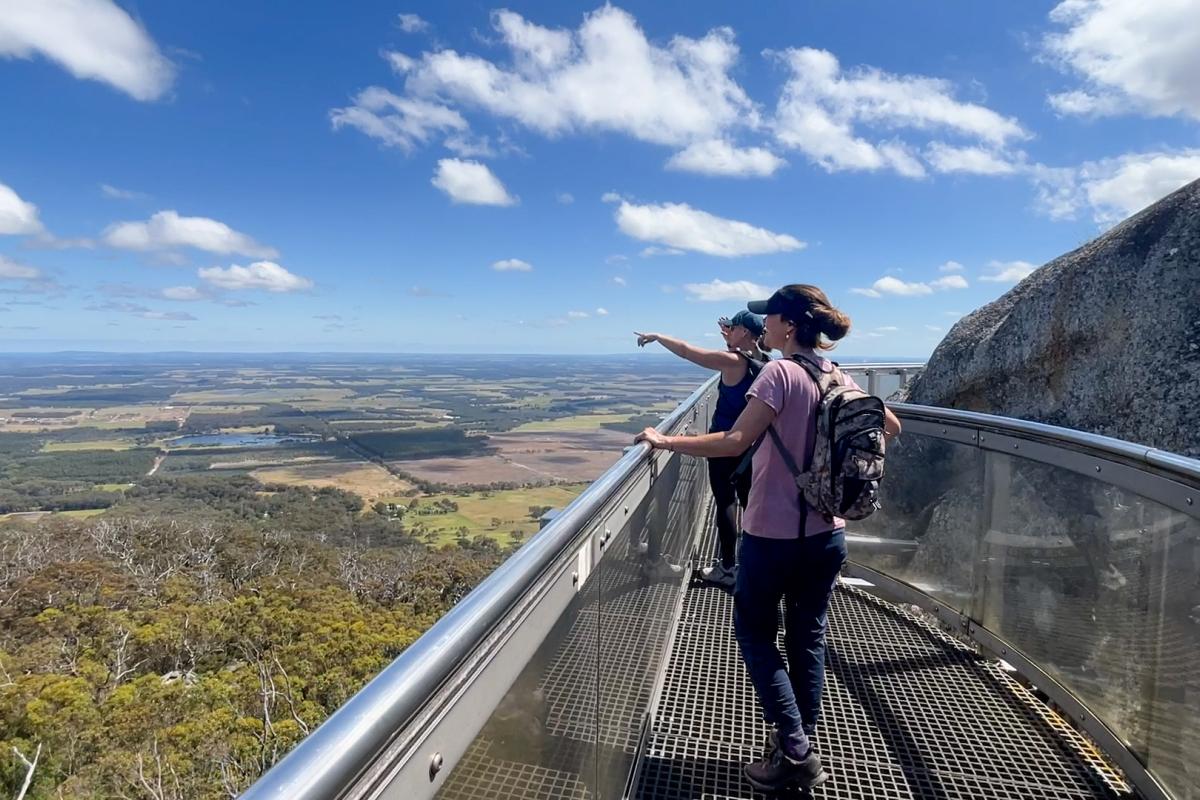
To get up close to the natural environment, there are a number of trails and recreation areas, including the well-known Castle Rock (see ‘Castle Rock: Walking in the clouds’ LANDSCOPE, Winter 2012) with its suspended walkway looking over a rail to the horizon and through a grid to the forest floor. Known as the Granite Skywalk, the 100-metre scramble over granite rocks and an eight-metre-high ladder is reached by first completing a tough two-kilometre uphill walk.
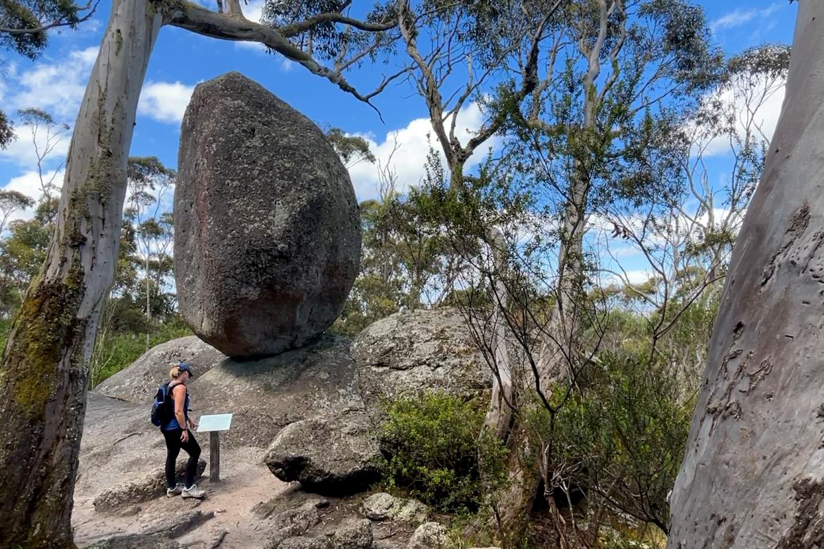
Just a few kilometres away from the popular Castle Rock and Granite Skywalk, nestled in Menang Country, Karri boya-k (formerly known as ‘Tree in the Rock’) is a day-use recreation site offering much more than its name would suggest. Karri boya-k boasts a series of breathtaking natural trail experiences with the unique tree growing from the granite, located just 100 metres along a shaded walk. Outdoor enthusiasts can make a day of it, exploring the trails while revelling in stunning views of the surrounding peaks and iconic Stirling Range in the distance.
The trails and facilities at Karri boya-k have recently undergone a significant improvement, made possible through the $15 million Great Southern Adventure Trail initiative funded from the State Recovery Plan. To accommodate the increasing number of visitors and showcase the natural beauty of the tall karri trees, several improvements have been made to the site’s visitor facilities including new interpretive and directional signage for the trails as well as a new shelter and trailhead.
Carpark upgrades provide an additional 27 vehicle spaces, along with two dedicated bus/long vehicle bays, which ensure smoother traffic flow.
Universal access pathways have been constructed to allow easy access to picnic areas, barbecues, toilet facilities, and the tree growing from the granite providing improved access for more visitors to Karri boya–k.
Do it yourself
- Where is it? 40 kilometres from Albany, north along Chester Pass Road. 400 kilometres from Perth via Mount Barker-Porongurup Road and Bolganup Road.
- Total area: 2511 hectares.
- Things to do: Bushwalking, picnicking, rock climbing, abseiling.
- Facilities: Barbecues, toilets and picnic tables.
- Park fees: Entry fees apply.
- Nearest Parks and Wildlife Service office: South Coast Regional Office, 120 Albany Highway, Albany (08) 9842 4500.
Trail improvements to Karri boya–k
Nancy Peak Trail: this popular 5.5-kilometre loop trail has been upgraded with nearly 1300 stone steps to address steep and eroded sections. Additionally, the trail has been realigned to avoid sensitive granite areas, respecting both cultural and environmental values.
Wansbrough Walk: minor enhancements have been made to improve this eight-kilometre-return hike.
Tree in the Rock: 100 metres of newly sealed accessible pathway to small viewing space.


