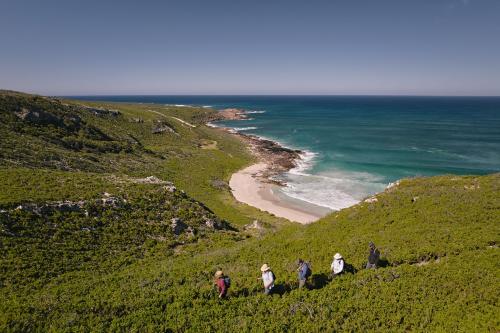
Discover the many multi-day bushwalk trails in Western Australia's parks. Trails like the Bibbumun Track, Cape to Cape, Mamang, Hakea, Wiilman Bilya, Yonga and Coastal Plains are overnight or longer. 

Learn about staying safe on trails by planning and preparing before you go in our Safety section of this website.

Long trails in Western Australia

Explore the 1003km walk trail through some of the best scenery of the Experience Perth and South West regions.

Adventure out on this 1000km cycle trail along purpose-built trail, forest tracks and roads in the Experience Perth and South West regions.

Discover the 130km coastal walk trail between the lighthouses at the capes for which Leeuwin-Naturaliste National Park in the South West region is named.

Trails in WA Parks

Click a trail for more information on Trails WA.

Bush Walk
6 kilometres

This easy six kilometre return trail runs from Walpole Nornalup Visitor Centre to the Coalmine Beach Caravan Park on the scenic Nornalup Inlet. It traverses interesting swampland, with much of the walk on boardwalk.

Bush Walk
52 kilometres

This three day, 52 kilometre walk between Yanchep National Park and Neaves Road, in the Melaleuca Conservation Park, traverses the National Park as well as the inland coastal plain.  There are three overnight campsites along the way.

Bush Walk
20 kilometres

The Coastal Trail is a spectacular, but challenging 20km walk trail in Cape Le Grand National Park, 30 minutes drive from Esperance. The experienced walker can hike from bay to bay, enjoying some of the best scenery in Australia; kangaroos basking on pristine white beaches, dolphins surfing the aqua waters and amazing views.

Bush Walk
4 kilometres

This easy four kilometre trail is the most westerly loop of the Cape Naturaliste Walk Trail Network, taking you nearly all the way to the tip of the cape with spectacular views along the way.

Bush Walk
123 kilometres

The Cape to Cape Walk Track runs for 123 kilometres along the Leeuwin-Naturaliste Ridge, between the lighthouses of Cape Naturaliste and Cape Leeuwin in the far south west of Western Australia.  It features spectacular coastal and forest scenery, a fascinating geology of cliffs, caves, headlands and rock formations and an ever-changing display of vegetation and wildflowers.

Bush Walk
1.6 kilometres

The Caldyanup Trail is a moderate 1.6 kilometre loop trail around the base of the granite mass in Mount Frankland National Park near Walpole.  This lovely trail winds through one of the best granite and karri areas in Australia’s South West.

Bush Walk
4.5 kilometres

Circumnavigate the Shannon campground on this easy 4.5km loop through the forest.  The trails follows old railway formations and forestry tracks and is suitable for bikes and walkers.

Bush Walk
3.5 kilometres

This 3.5 kilometre length of the Cape to Cape track is wheelchair accessible and provides stunning coastal views between Cape Naturaliste and Sugarloaf rock.

Bush Walk
3.6 kilometres

This 3.6 kilometre walk lies at the tip of Cape Naturaliste near Dunsborough.  It offers superb cliff top views and has the option to drop down to Shelley Cove at the eastern end.

Bush Walk
1.4 kilometres

The Blue Wren Ramble is a fairly easy 1.4 kilometre one way walk that follows Ellis Brook. It passes through Wandoo Woodland, a prime nesting and feeding area for birds. Dense thickets along the banks of the Brook provide a cool, shaded walk.

Bush Walk
6.8 kilometres

Bluff Knoll is located in the Stirling Range National Park, 4.5 hours south of Perth and 1.5 hours from Albany on the south coast. This 6.8km return,  Grade 4 trail is well signed and takes you to the top of Bluff Knoll, 1098 metres above sea level, via a steep path with numerous step to negotiate. The views from the summit are spectacular and worth the effort to get there

Bush Walk
600 metres

A short and easy 600 metre loop trail beneath the towering Karri trees to Bolganup Creek and return back to Tree-in-the-Rock picnic area. A great option for all the family.

Bush Walk
1.4 kilometres

The Boolagoorda Trail starts and ends at the Hamelin Pool Telegraph Station. It takes the visitor on an easy flat 1.4 kilometre loop walk to a 200 metre boardwalk.  From there you can experience the world’s oldest lifeforms, known as stromatolites, thriving in the shallow seas.

Bush Walk
1 kilometre

This short one kilometre walk around Contine Hill provides expansive views illustrating the contrast between farmland and the original dryandra woodland which existed before extensive clearing.

Bush Walk
1.2 kilometres

Visitors can admire the spectacular views of the Murchison River Gorge, from the overhanging rock formation of the Z bend lookout, a moderately easy walk from the carpark.

Bush Walk
2.6 kilometres

For the more adventurous hikers, once admiring the views from the Z Bend Lookout, you can embark on the trek down into the gorge, meandering between boulders and river red gums to reach the Murchison River.

Bush Walk
1.6 kilometres

This 1.6 kilometre return walk to the blowholes provides a wonderful view of the rugged coastline of Torndirrup National Park.  Be warned that there are 78 steps and the walk back is all uphill!

Bush Walk
2 kilometres

Yardie Gorge Trail is a two-kilometre walk overlooking the ancient Yardie Creek gorge. With amazing views of red limestone cliff faces and the opportunity to see a wonderful array of birds and wildlife, including the rare black-footed wallaby, euros and red kangaroos. From the top, the views into the creek and out to the Ningaloo Reef are purely spectacular.